
 Photos by Jenna Cho (@TheDailyCho)
“It has to be here!” I yelled.
Jenna looked at me incredulously. “It could be anywhere under the snow,” she said.
I kept scouring the ice-and-snow-covered rocks. We’d been awake since 6 a.m., wandering for hours through drifts of Vermont’s tallest mountain.
“If we’re at the highest point,” I said, “shouldn’t we see the marker?”
I was determined to find the true summit of Mt. Mansfield. With the wind howling and the clouds swirling — a typical mid-winter day — I got down on my knees and started scraping snow and ice off the rocks, searching for the small, circular, summit-marking plaque left by the U.S. Geological Survey to mark the zenith of Vermont, at 4,393 feet.
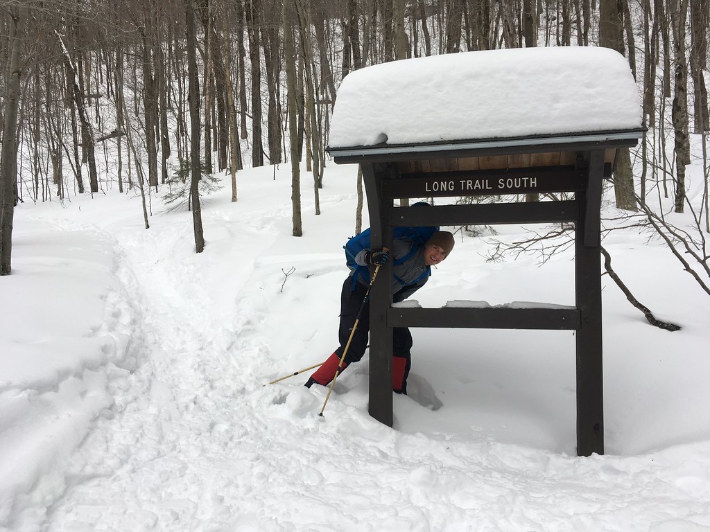
Our trek had begun the previous afternoon, far below in Smuggler’s Notch, at the southbound trailhead of the Long Trail, near the entrance to Stowe Mountain Resort and a gondola that could have whisked us up several thousand feet to the summit ridge. But that’s for lazy skiers and snowboarders. In the parking lot, Jenna and I had strapped on gaiters and snowshoes and started up the Long Trail with 30-pound overnight packs.
We’d already tried once to climb to the true summit of Mt. Mansfield. The previous summer, just before scrambling up to the south side of the long summit ridge, a thunderstorm turned us back — along with a warning from a descending hiker that he’d just navigated a brutal two miles of lighting strikes, thunderclaps, and hail. We instead took the Bad Weather Route down.
Now back for a February ascent, I was determined to stand atop the true summit. Mansfield, however, seemed determined to elude me. Not long after we started snow-shoeing up the Long Trail, the trail markers vanished. Whoever thought it was a good idea to mark a trail with white blazes that would disappear in the winter snow? (The Appalachian Trail is also marked with snow-white blazes, which likewise proved to be problematic during a winter hike from Mt. Pico to Mt. Killington several years ago.)
Jenna and I wandered through the forest, following unofficial ski trails that seemed to go in the general vicinity of up. We moved at about 1 mph under a light snowfall.
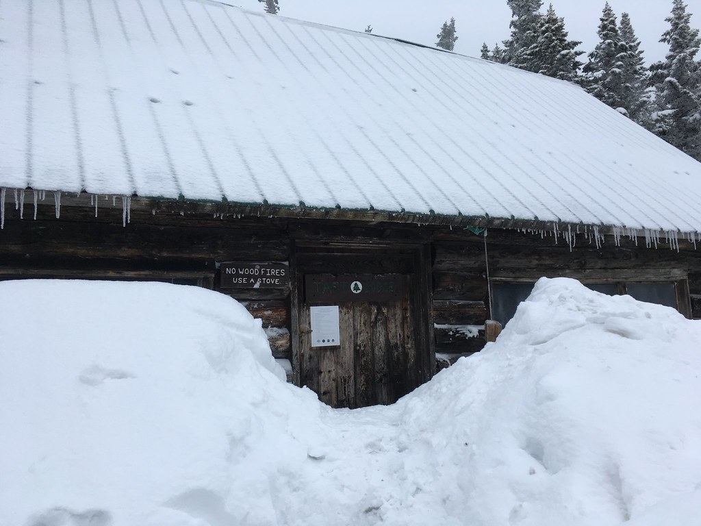
Fortunately, at some point, we wandered back onto the Long Trail. After about two miles and 2,000 feet of elevation gain, we reached our overnight destination of the Taft lodge: an unheated, un-electrified, un-kept cabin at 3,650 feet elevation — 750 feet below the summit. From May to October the hut costs $10 a night, but it’s free in winter, when it’s buried in snow.
The hut was empty but it reeked of marijuana, presumably from skiers who use this as a wind-free place to toke up. I shoveled out the entryway and we laid our sleeping pads and bags on the wooden bunk platforms. While making tea using my Jetboil stove, Jenna discovered something slightly concerning: our fuel canister was perilously close to empty. Without fuel, we wouldn’t be able to melt snow, which was our sole source of water.
By 5:30 p.m. it was dark. Just when we assumed we’d be alone for the night, we heard voices outside. Seconds later, two 20-somethings on splitboards tromped in with a draft of freezing wind and said how happy they were to finally find the cabin after wandering for hours through the surrounding forest. They’d ridden the gondola up from Stowe (lazy!), then skinned a half-mile across the mountain to where they expected to intersect the Long Trail — but, as we had already discovered, the Long Trail is hard to find in winter.
Later, we’d heard that another backcountry skier actually did get lost atop Mt. Mansfield that night, spurring Stowe’s ski patrol to do an emergency rescue. And, coincidentally, yet another skier disappeared that same night on Mt. Whiteface, on the other side of Lake Champlain in the Adirondacks. I only mention him because his story is so bizarre: the guy mysteriously turned up days later in California, unsure how he’d gotten there, as if he’d fallen into some kind of inter-dimensional black hole atop the mountain. True story.
We awoke in Taft Lodge at 6 a.m. It was around 20 degrees inside the hut, which was warm for February. We had just enough fuel to boil water for coffee and melt snow for 2 liters of drinking water — which I considered the minimum we’d need for the day. We were back on the Long Trail by 7:30 a.m. A fresh layer of snow had fallen overnight, but the clouds seemed to be lifting and we could almost see up to the summit. Seemed like we’d be there in no time.
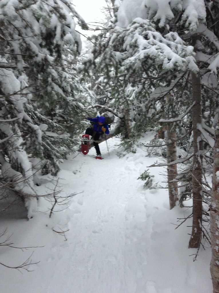
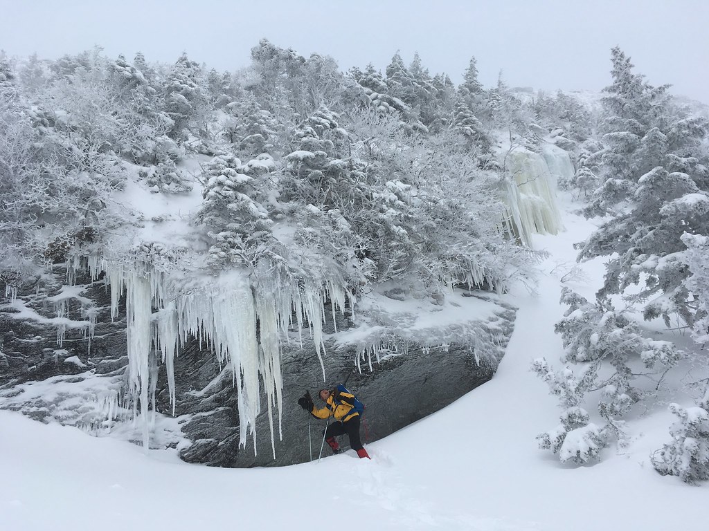
We had to watch for falling icicles…
All was going smoothly until the Long Trail disappeared again. It was obvious that we needed to hike up, but an unidentified set of boot prints was steering us sideways, about 500 feet below the summit ridge. Suddenly, we emerged from the woods in front of the Stowe gondola, which was unloading hoards of skiers and snowboarders onto the slopes.
I spotted a ski patrol worker and asked where to find the trail to the summit ridge. He said we’d already passed it. After a brief attempt to trail-blaze from the gondola straight up to the summit ridge through three-feet-deep snow, we doubled back and retraced our steps until we reached a steep section that appeared to resemble a path called the Profanity Trail. It was steep. I was quickly dripping sweat. I held back the profanities.
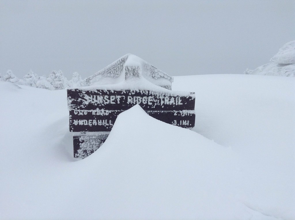
Finally we topped out and saw our first sign of the day, a wooden post marking the Sunset Ridge Trail. We were now supposed to only be a few hundred feet from the summit…
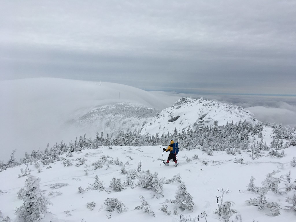
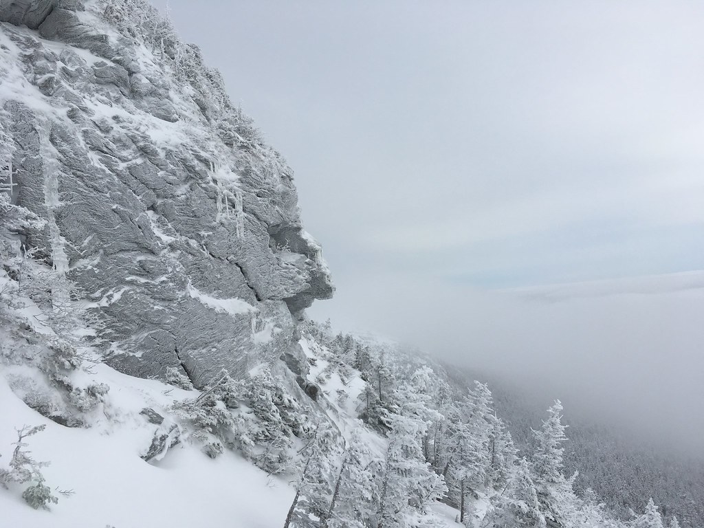
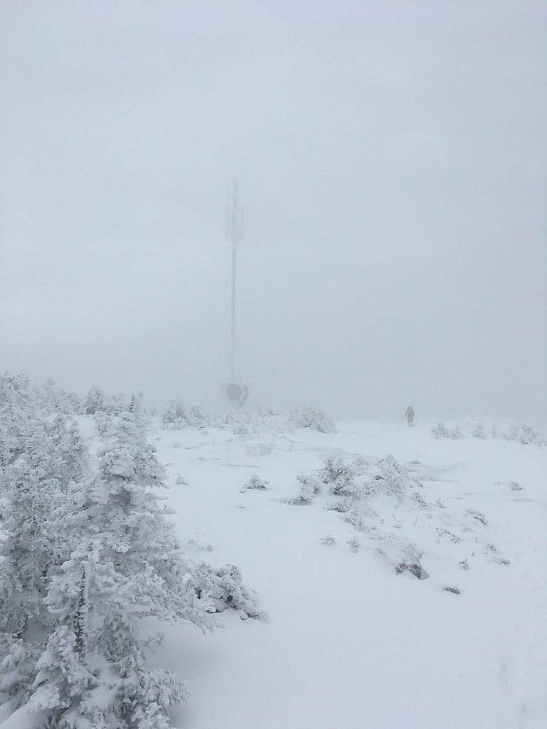
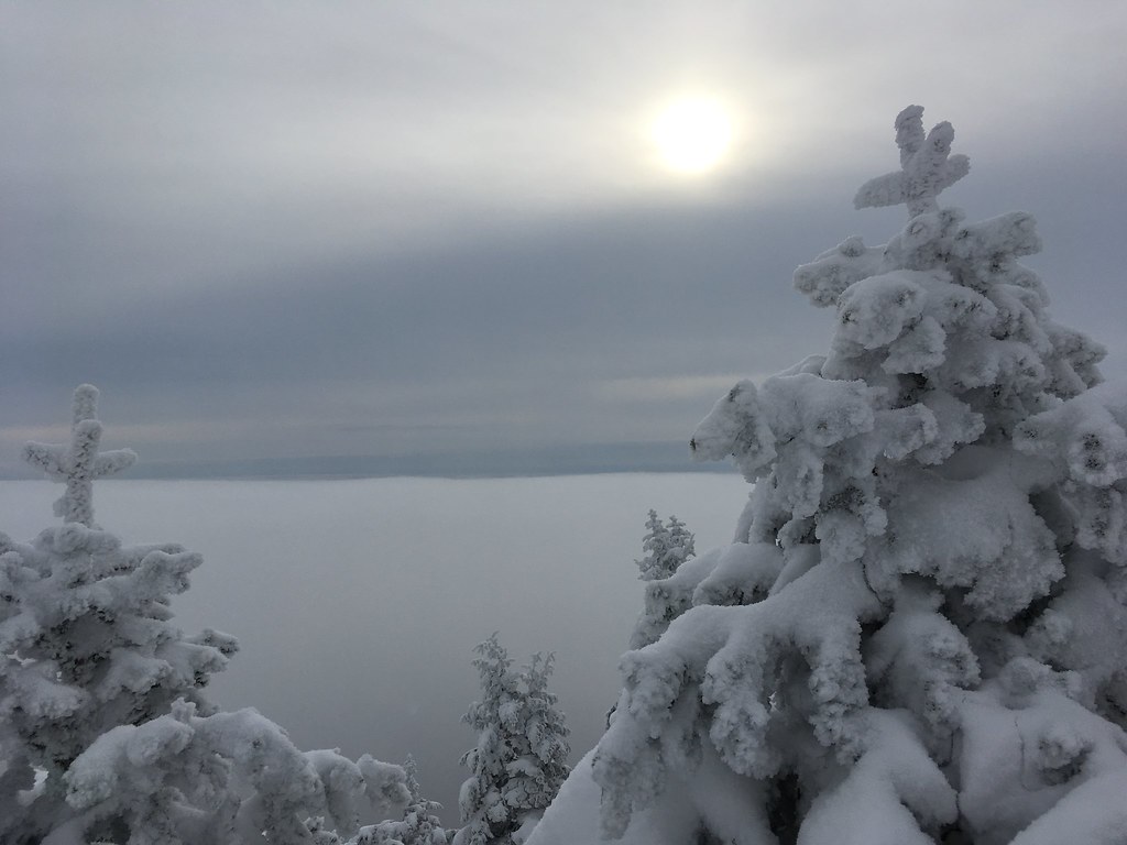
We wandered upward and into the fog, first to a spot called the West Chin, which we thought was the summit until the clouds broke and we saw another slightly higher bump, which we assumed was the true summit, called the Chin. (Mt. Mansfield supposedly resembles a human face looking upward, and so its ridgeline is identified by facial features: the Adam’s Apple, the Chin, the Lips, the Nose, the Forehead.)
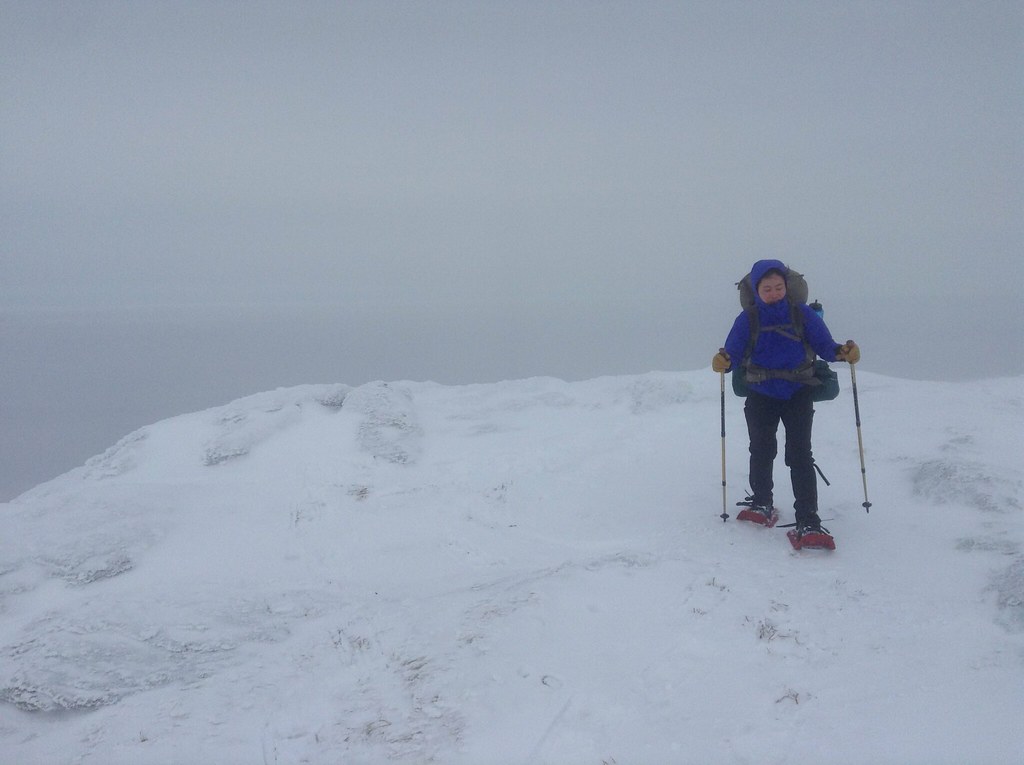
We pushed up until we couldn’t seem to go any higher…
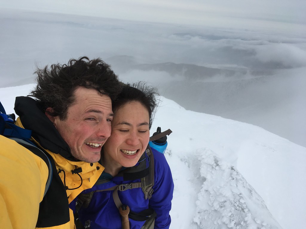
But try as I might, I could not find that summit-marking plaque! In the end, Jenna and I think we summited Mt. Mansfield, but there was no proof we actually stepped atop the true summit. Guess I’ll have to come back, again.
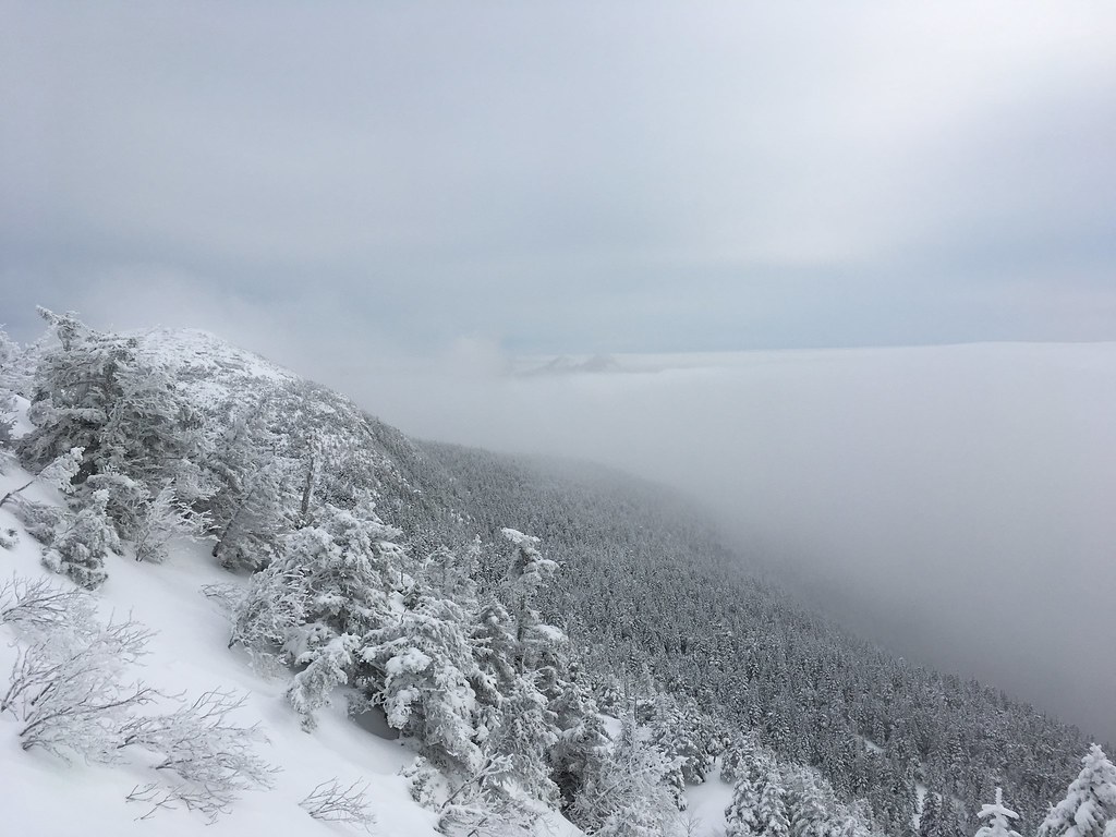
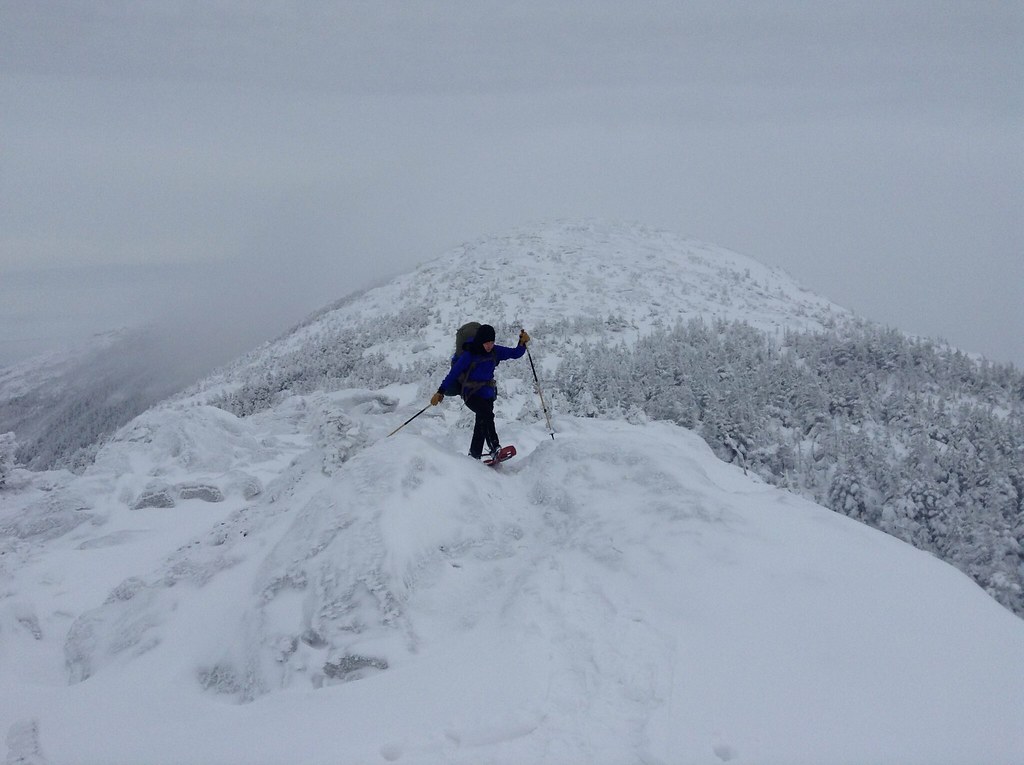
From there, we doubled back to the intersection with the Sunset Ridge Trail and then traversed about 1.5 miles across the summit ridgeline, passing over the Lips and then to the Nose. The whole journey was a bit foreboding. Unlike in the White Mountains, on Mt. Mansfield there were no cairns above treeline to mark the trail or prevent us from veering toward a ravine or into the wildernees. With thick clouds rolling over the ridge, we could only catch occasional glimpses of our path forward — but they were spectacular glimpses, when they did appear.
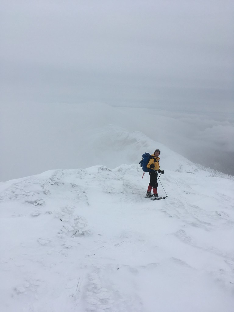
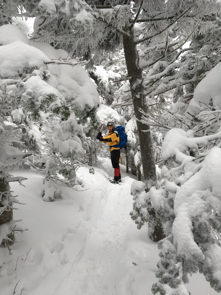
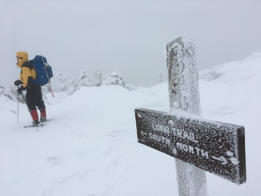
Occasionally a half-covered signpost reassured us we were moving in the right direction…
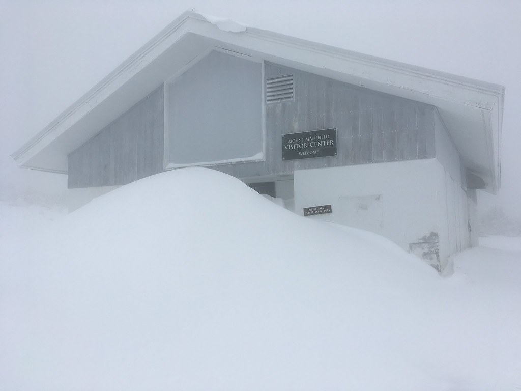
Close to the Nose, we passed the Mt. Mansfield Visitor Center, which is accessible by auto road during the summer months but now was very much snowed in.
And from there we descended via the Haselton Trail, which we eventually found after crossing a few ski trails in the process, which may have been the most dangerous part of the trek considering the risk of skiers slamming into us. We reached the valley just as an icy rain started, and we were back at the car a bit after noon — more than ready for lunch at the nearby Von Trapp Brewery.
Looking up toward Mansfield, the mountain was now totally socked in, another layer of ice and snow burying the elusive summit marker.
 Photos by Jenna Cho (@TheDailyCho)
Hello,
I am the editor of the Appalachian Trail Conservancy’s membership magazine, and we are looking for some nice A.T. Winter images to possibly publish in our upcoming Winter 2020 issue.
I love some of these photos (I know all are not on the Trail) – would you be interested in sending me the higher res versions of any/all of these that were taken on/near/from the A.T.? We do compensate. We would need them as soon as possible if we will be able to consider any for the Winter issue. I look forward to hearing from you at your soonest convenience 🙂
Thank you!
-Wendy K. Probst
Pingback: The Causeway Way | Stephen Kurczy